A Forest Worth Preserving
*NOTE: Click on images to enlarge
Everyday, thousands of people drive past the Cariboo Heights forest, yet it is unknown to most of them. When people do notice this large forested area, they assume it’s a park—but it’s not.
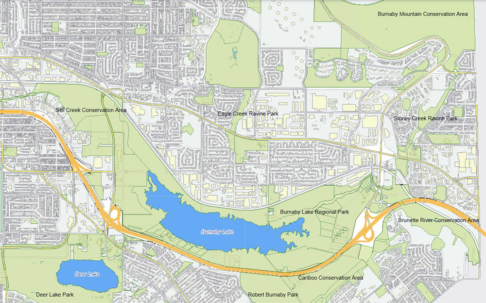
In the middle of this busy urban area, the forests of Burnaby’s central valley connect to form an oasis for people and wildlife. Animals such as black bear, coyote, bobcat, Washington snowshoe hare and the occasional cougar move freely through the linked parks and conservation areas.
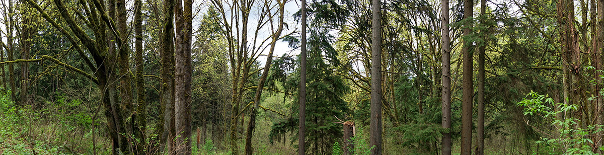
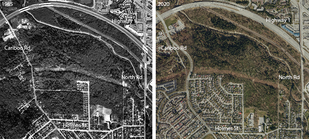
The Cariboo Heights forest is located on the north slope of Cariboo hill, south of the Brunette River, east of Cariboo Road and west of North Road. It is about 47 hectares (116 acres) of towering big leaf maples, western hemlock, black cottonwood, western red cedar, red alder and an amazing diversity of native plants and wildlife.
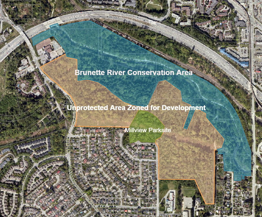
Approximately 17 hectares (43 acres) of this forest is protected as part of the Brunette River Conservation Area. The remaining 27 hectares (67 acres) were zoned for development in the 1987 Cariboo Heights Community Plan. Less than 3 hectares (about 6.5 acres) were proposed to be protected as Millview Park.
This community plan is old and outdated. It was approved at a time when the Burnaby city council had different priorities. The mindset was to cut down forests and build suburban lots. Skytrain was under construction and higher density developments at Metrotown were just beginning. The importance of urban forests and dangers posed by climate change were not yet widely known.
Since 1985, Metro Vancouver’s population has increased by more than a million people and we have lost a lot of nature. In fact, between 2009-2014 the Metro Vancouver region has lost more than 1,600 hectares (4,000 acres) of forest—equivalent in size to four Stanley Parks!
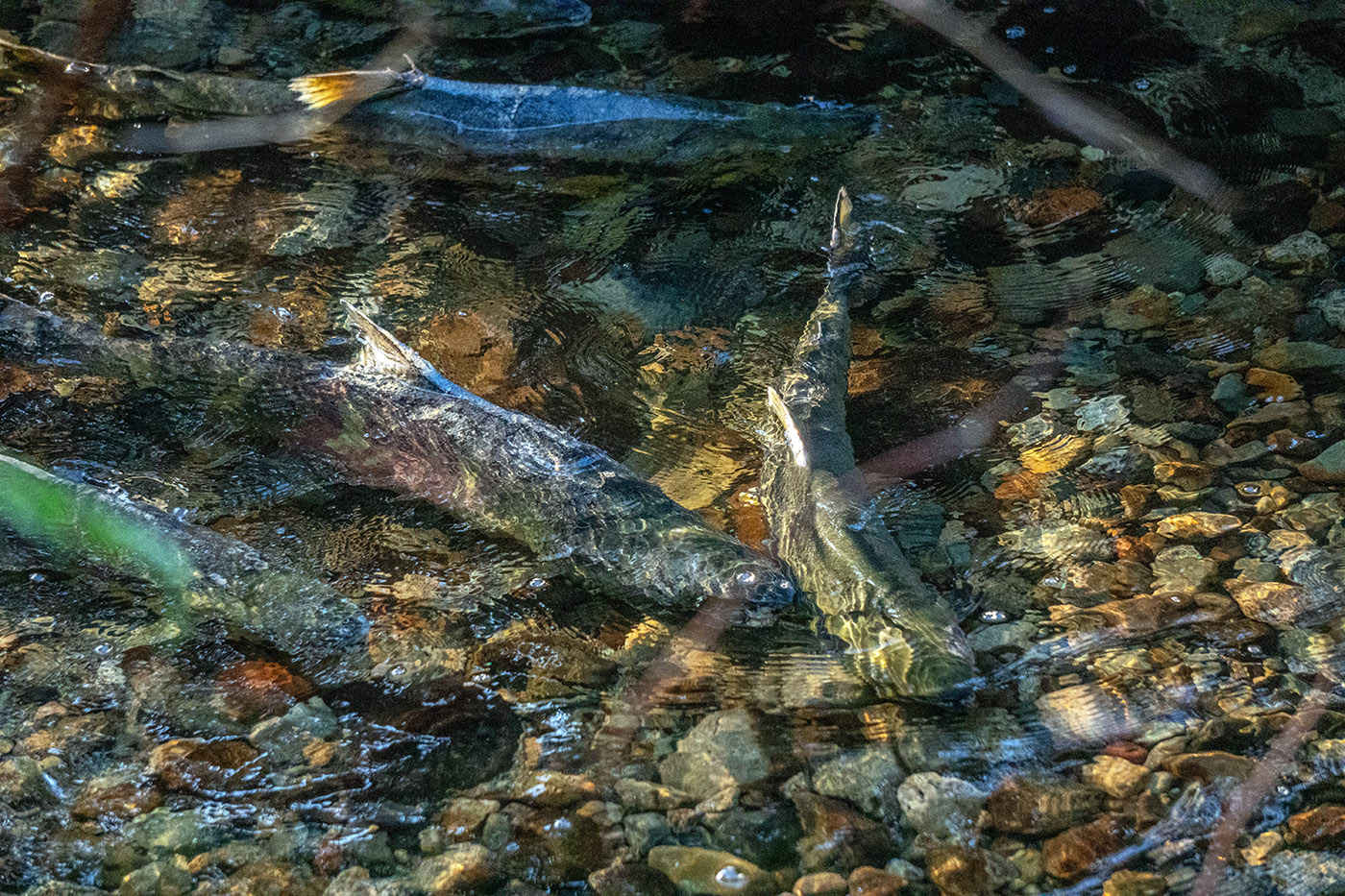
Salmon now return each year to spawn in the Brunette River and their future success depends on maintaining water quality in the river. In turn, water quality hinges on having healthy forests surrounding the Brunette River and its tributary creeks to keep the water cool and clean. The Cariboo Heights forest is the only unprotected natural part of the Brunette River watershed.
In the last decade, the City of Burnaby has approved progressive strategies and policies on community housing, environmental sustainability, and has declared a climate emergency. Preservation of this forest fits with these new policies and our better understanding of the importance of urban forests. The City of Burnaby already owns the Cariboo Heights forest lands, so no land purchase is needed.
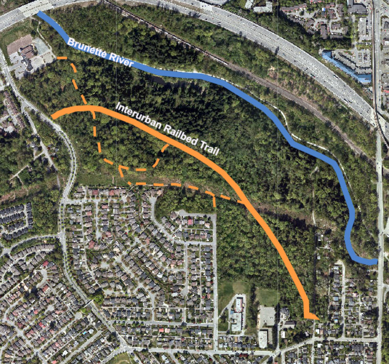
The last intact section of rail bed of the BC Electric Railway’s Burnaby Lake Interurban line bisects the forest. The railway operated from 1911-1953 and shaped the development around Burnaby Lake and Cariboo Heights. Today the railbed is an easy walking route between Cariboo Road and Holmes Street, accessible to young and old.
» Read the Benefits of preserving the Cariboo Heights forest
Burnaby’s City Council has a unique opportunity
to preserve this part of Burnaby’s natural and historic legacy.