History of Cariboo Heights Forest
*Note: Click on image to enlarge.
First Nations
The Cariboo Heights area tells the story of primeval forests, indigenous communities, an early transportation corridor and settlement in Burnaby’s central valley.
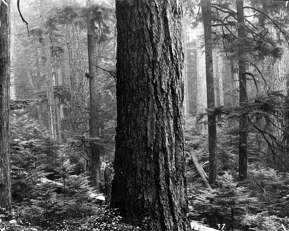
Two hundred years ago, Cariboo Hill was covered in old growth forests of towering Douglas fir, western hemlock and western red cedar. Giant Sitka spruce grew along the banks of the Brunette River and around Burnaby Lake. Some of these trees may have been more than 1,000 years old! The trees were covered with moss and their branches were hung with drooping masses of lichen. The forest floor was carpeted with a thick layer of mosses, lush ferns, huckleberry, osoberry, and salal bushes. Giant fallen trees acted as nurse logs for seedlings and young trees.
The Brunette River lazily wound its way from Burnaby Lake to the Fraser River—its banks dotted with many beaver lodges. Deer, elk and snowshoe hare grazed within the thick tangle of willow and alder shrubs along the edges of the river and Burnaby Lake. Bear fed upon the abundant salmonberries, thimbleberries, wild crabapples and spawning salmon who returned to the many creeks flowing into Burnaby Lake and the Brunette River. Wolves, cougars and bobcats prospered in this rich habitat.
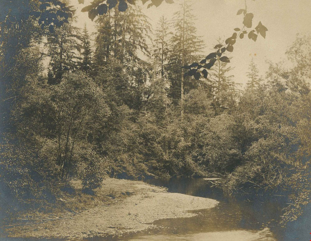
Indigenous people from the Hən̓q̓əmin̓əm̓ and Sḵwxwú7mesh groups lived in long-term villages on the banks of the Fraser River, by the mouth of the Brunette River. They travelled by canoe between different seasonal camps at Deer Lake, Burnaby Lake and along the Brunette River. Hən̓q̓əmin̓əm̓ and Sḵwxwú7mesh families traditionally gathered food such as crabapples, cranberries, labrador tea, cattail and wapato around the shores of the lakes. They hunted the deer and elk that grazed around the lakes and along the river bank.
Historically, the Brunette River had very abundant salmon runs. Mrs. A. R. Green, daughter of William Holmes, Burnaby’s first settler, remembered the salmon runs at the turn of the century: “So plentiful were the salmon which passed up the Brunette during the spawning season that they actually crowded each other out of the water. If they had remained stationary, we could have walked over the stream without getting our shoes wet.”
In the fall, many Hən̓q̓əmin̓əm̓ and Sḵwxwú7mesh families would camp along the Brunette River as they fished and dried salmon for their winter food.
Colonization
Dramatic changes occurred to the forests and to the indigenous peoples in the 1800s. The arrival of early explorers and fur traders introduced diseases which decimated the indigenous populations.
In 1825, Fort Langley was founded by the Hudson’s Bay Company. Then, the discovery of gold on the Fraser River started a human stampede to the area. The settlers were concerned that the arrival of thousands of American miners might lead to annexation by the United States. They pushed for the incorporation of the Colony of British Columbia in 1858.
Major-General Richard Moody founded New Westminster as the capital of the new colony in 1860. He chose the site on the steep forested hill because it had excellent views over the Fraser River and land to the south. This allowed them to keep watch for invaders.

The first homesteaders in Burnaby were William Holmes and his family. He built a log cabin just west of the present day North Road bridge over the Brunette River. These early settlers got their land through a process called pre-emption. By clearing the forests and building houses they were able to claim the land for their own. Indigenous people were not allowed to use pre-emption and were dispossessed from their traditional lands. Logging permits allowed settlers to cut the forests which were home to plants and animals upon which the indigenous people depended for their food.
In the late 1800s, the area between the City of New Westminster and the City of Vancouver was mostly forests and was sparsely settled by a few hundred people. Many of these early settlers cleared the rich lands between Still Creek and Deer Lake to establish berry farms, orchards and small market gardens.
Logging
George Green, who wrote the “History of Burnaby”, described North Burnaby and the central valley in the late 1800’s: “… an immense amount of big timber lay untouched and the wild deer and the bear roamed at will, the cougar still crouched above the accustomed path of its prey, and the beaver built its lodge along the forest stream. Giant monarchs of the wood threw their towering heads 300 feet high to catch the sunlight, or bent their branches before the gale.”

In 1892, Rowling and Company, based near Still Creek, started to log for valuable cedar and fir trees around Burnaby Lake. Their plan was to float their logs down the Brunette River to mills in New Westminster. To achieve this, they built a dam and a flood gate across the Brunette River where it flowed out of Burnaby Lake They also removed boulders and fallen trees in the river bed that prevented the free travel of their logs.
The City of New Westminster feared the floating logs would damage the central support of the new North Road bridge that had just been constructed over the Brunette River. They issued an injunction against the Rowlings logging company but the ensuing lawsuit was eventually settled in favour of the logging company.
The global depression in the mid 1890’s caused the price of logs to drop and most logging operations in Burnaby stopped.
About ten years later, the Connor logging company logged the remaining cedar and fir around Burnaby Lake and the Cariboo Heights.
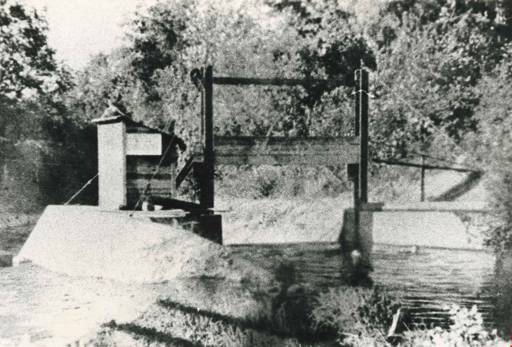
They obtained permission from Mr Rowlings to use the Brunette River to float their logs and shingle bolts to the Brunette Sawmill on the Fraser River and paid him a toll of $0.25 per thousand feet.
There are no records of how large the trees in the Cariboo Heights forest were. In other parts of Burnaby, loggers cut cedar trees that were 33 feet in circumference. One very large fir tree had a diameter of 12 feet.
These pioneering logging companies supplied raw logs for the mills and cleared land for settlers.

A section of the Cariboo Heights forest was logged again in 1933. Mr Bresser, of Government Road, cut hemlock trees from the forest just east of Cariboo Road for firewood. He paid the City of Burnaby on a stumpage basis of $0.25 per cord of wood. A cord of wood is 128 cubic feet or a well-stacked woodpile 4 feet high, 8 feet wide, and 4 feet deep. Today, a cord of seasoned hemlock would cost about $300.
Mr. Bresser applied to Burnaby City Council later in 1933 to cut the remaining hemlock trees in this area for lumber. He offered to pay $0.50 per board foot. However, Burnaby City Council denied his request, stating that “no further commercial and cutting permits are being granted owing to the large number of unemployed persons requiring wood for their own use”.
The Great Depression (1929-1939) was devastating for the City of Burnaby. Towns and cities were responsible for relief payments to the unemployed. As homeowners defaulted on their tax payments, Burnaby’s relief fund was used up. Council came up with inventive ways to support struggling residents, allowing them to hunt and collect food in undeveloped areas of Burnaby and cut firewood for their own use.
Transportation and Settlement
At the turn of the century, the only connections between the cities of New Westminster and Vancouver were rough wagon roads which later became Kingsway, Marine Drive and Canada Way. To improve transportation between the two cities, the BC Electric Railway built the Central Park Interurban Line in 1891. At this time, most of the route was surrounded by forest. Anticipating further development and settlement, local landowners pushed for the incorporation of the Municipality of Burnaby in 1892.
A few years later, the land on either side of the Central Park Interurban route was subdivided and sold. Parcels of land were originally offered for $100 per acre but the land clearing proved to be so difficult that the government had to reduce the price to $60 per acre. The plots of land were full of big stumps and overgrown bush. The giant stumps often had to be blasted out of the ground by using “stumping powder” or dynamite.
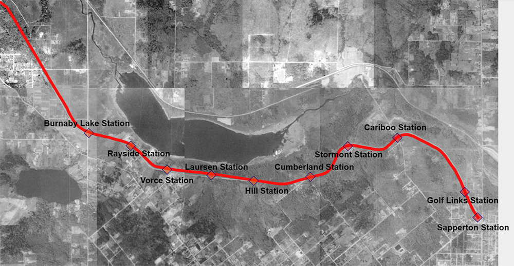
The development stimulated by the Central Park Interurban line convinced the BC Electric Railway to expand service and build a new line along Burnaby lake. They bought up recently cleared land in hope that the line would bring in settlers and development.
Construction began on the Burnaby Lake Interurban line in 1909 and the last spike was driven two years later in 1911. To prevent sinking tracks and trains on the unstable boggy soil, part of the line was floated on a tightly tamped bed of wood chips over the boggiest areas. The Trans Canada highway had to use the same floating road bed concept when it was built over the former route of the Interurban.
The large suburban development planned for the south side of Burnaby Lake never took place as the economy stalled again in the depression of 1912. The bogs and swamps surrounding Burnaby Lake also made development difficult.

Despite promotion by real estate agents, many of the grandiose development schemes never took place, including a plan to develop Burnaby Lake as a waterfront resort. A lot of investors lost their money.
Burnaby residents used the Interurban to commute to New Westminster and Vancouver for work, shopping, attending church and theatres, and to transport packages and goods.The line was busier on holidays and was marketed as part of a ‘scenic tour’.


When the lakes froze in the winter, extra runs were put on for visitors to go skating.
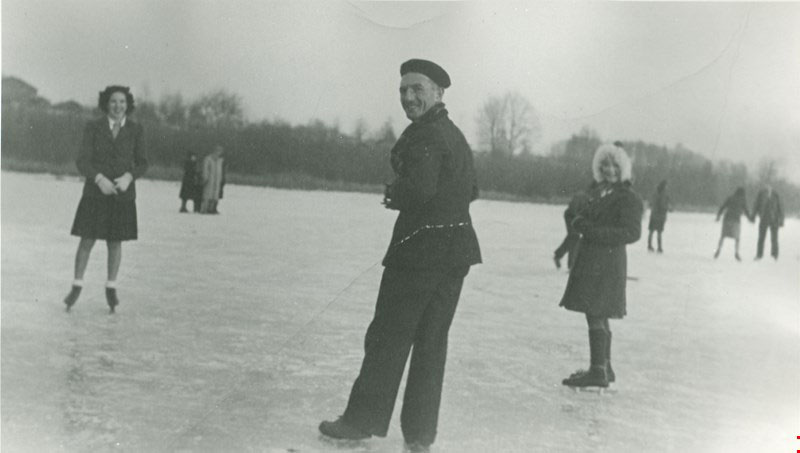
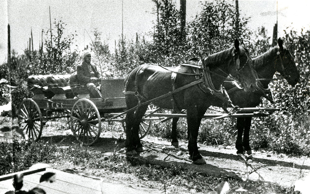
The Cariboo Heights forest lies between the former Cariboo and Golf Links stations. The Golf Links station was built at the request of the members of the Vancouver Golf Club.
In 1910, the founding members bought 200 acres of a former sheep farm on Austin Ave in Coquitlam. They hired a horse and carriage that would meet club members at Golf Links station and chauffeur them to and from the golf course.
In 1917, the club replaced the wagon with a McLaughlin Buick to provide a more comfortable and speedy ride to its members.
At the end of the second World War, the BC Electric Railway was faced with the need to modernize its fleet, tracks and electrical equipment. They decided to launch a 10 year program to convert “rails to rubber”, buying trolley busses that could use the existing overhead electrical cables. The last Burnaby Lake Interurban trip was in 1953. Shortly afterwards the rails, ties and electrical lines were removed.
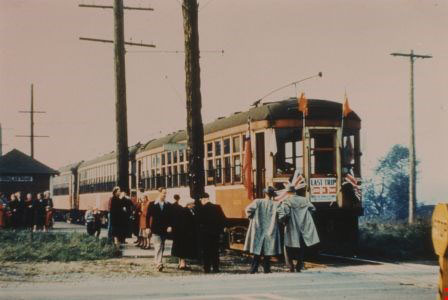
In the 1960’s the Trans Canada highway was built over much of the route along Burnaby Lake and now most residents do not know that the Burnaby Lake Interurban line ever existed.
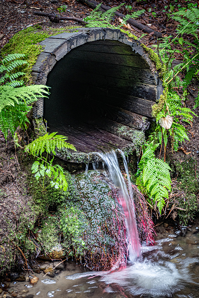
Today you can still find traces of the interurban line along the forest trail. The stumps of the former power poles can be seen spaced at regular intervals. Ancient Grove creek still flows through a functioning wooden culvert that was installed in 1911 during the railbed construction.
